Showing posts with label Geocaching. Show all posts

Saturday, March 18, 2006

Write a Good Geocaching Log

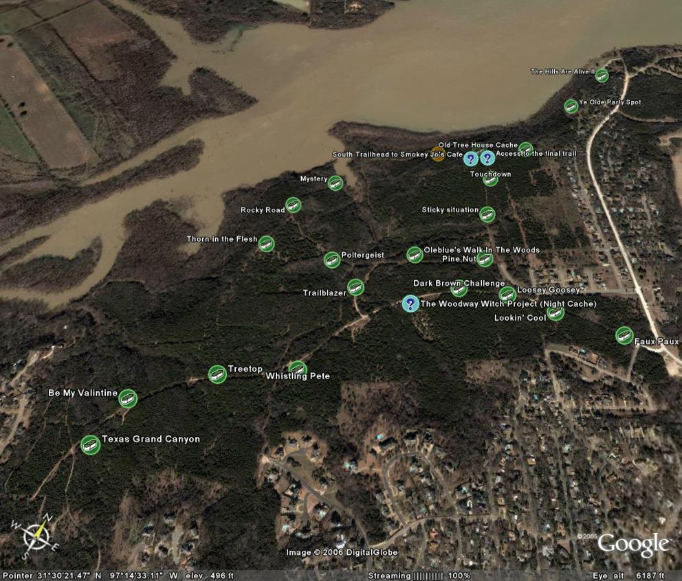
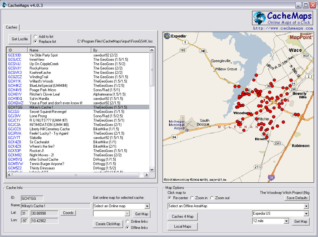
Most of the time, I pride myself in taking the time to sit down and write short, yet original cache logs on the Geocaching.com website for each of my finds. Unfortunately, at times, I fall into the trap of copy/paste logs - especially when I have just come back from a large cache run (or I just get lazy). This is a short excerpt from a blog post by Mike at jestcaching.com from last October. It is interesting reading.

jestcaching: Write a Good Geocaching Log
People that hide caches do so to share the experience with the finders. Most hiders look forward to reading the logs after somebody finds them. In most cases the hider puts more time into hiding and posting the cache than the geocacher that finds the cache. So why not reward the hider with a good log? We love reading logs telling the experience, especially ones that include some humor. It really makes our day to 1. know that somebody took the time to find one or our caches and 2. to hear about the fun (or sometimes frustration) they had while finding it. That being said we would like to introduce a couple of our favorite log writers.

Oregon is a geocacher on the West Coast that writes epic logs. He has not been very active lately and his profile says that he is over 200 logs behind. If you read some of his logs you can certainly understand why. Some could be considered short novels. They not only talk about finding the cache, but also getting there and sometimes what is going on with his life. They are hilarious. We have spent many nights just sitting in front of the computer laughing at his musings.

Closer to home we have a geocaching team named Yodadog. We have met the team several times and have even walked the trails with them and each time it seems weird. That is because they write their logs in the third person or should we say third canine? They have an adorable Corgi that has been personified in their logs. Seeing them this weekend we asked who got the most email - The Master, The Mistress, or Yoda. Seems Yoda wins hands down. Go to their profile and read some of their logs if you are in need for some entertainment and a good laugh.

Tuesday, March 14, 2006

Public Use of Private Texas Land

Land-owner permission and the right to use public and private land have been very hot topics lately on both my local and state geocaching boards as well as the Geocaching.com forums. The first of the two most recent complaints came from our biggest local cache complainer. He was attempting to find a cache along a Texas river-bank and had to cross "private property" in order to access the cache location by land. The second recent complaint from this same person was about a set of publicly accessible and frequently used hiking and biking trails known by local cachers simply as "The Woods." This second location is the home to two of my own caches, The Woodway Witch Project (Night Cache) and Trailblazer, in addition to almost two dozen other caches placed over the past 6 months.

Ultimately, the issue really boils down to three big points:

  1. EVERYTHING is owned by SOMEONE.
  2. Texas law permits certain public use of private land.
  3. You aren't trespassing unless you are told you are trespassing.
One fairly recent piece of Texas legislation, S.B. 155, dealth with several issues regarding public access to Texas waterways and river navigation. The following information comes from an article called "Driven to Act" by Bob Sweeny - Staff Attorney, Texas Parks and Wildlife Department.
Section 1 recognized that public access to Texas rivers is "a right granted to individuals under the Texas Constitution." To protect public access, the bill makes it a misdemeanor to restrict, obstruct, interfere with, or limit public recreational use of a protected freshwater area except as otherwise allowed by law. S.B. 155 also extends comparable protections to recreational river uses other than hunting or fishing, such as canoeing, or birdwatching [or geocaching]. It is widely recognized that prudent exercise of the constitutionally protected navigation right can entail temporary use of riverbanks to portage or scout obstructions, though the banks may be private property. Thus, under S.B. 155, if private riverside property is used to portage or scout obstructions, the landowner does not bear any risk of permanent loss of a property interest. Should it become unnecessary to use that particular riverside property (for example, because the river changes course), the public right of use disappears.
With this in mind, placing caches like Along the River should be no problem at all as long as the trail along the edge of the river itself is used to gain access to and scout the cache location.
The second complaint about caches in "The Woods" is also not really an issue when you actually read Texas trespassing laws. Section 30.05, Texas Penal Code, provides that a person commits an offense if the person enters or remains on property of another without effective consent, and the person:
  1. had notice that the entry was forbidden, or
  2. received notice to depart, but failed to do so.
Trespassing occurs after a person has been notified that the property is off-limits, but remains on the property (this excludes emergency workers performing their duties). There are five ways listed in Section 30.05 to notify the public that trespassing is not permitted:
  1. through verbal or written notification,
  2. fencing and similar enclosures,
  3. signs posted on the property that are visible by the public,
  4. visible presence of crops,
  5. and using purple paint to post the property.
The 'purple paint' law in Texas took effect in September of 1997. The law requires that the purple paint markings must be vertical, at least eight-inches long and one-inch wide. The bottom of the mark should be between three and five feet above the ground. The markings can be no more than 100 feet apart in timberland and 1,000 feet apart on open land, and must be in a place visible by those approaching the property.
Texas law actually has several provisions for Adverse Possession, Prescriptive Easements, and Implied Public Dedication that will legally transfer ownership of trespassed land to a trespasser or will legally grant a trespasser the right to use another's land. If a trespasser uses a piece of another's property for a certain amount of time, Texas can legally transfer ownership of that property to the trespasser as adverse possession. If the general public uses another's property for a roadway, trail, shortcut, or access to another property or public land, Texas can legally assign permanent rights to the trespassers under a prescriptive easement or mark it as implied public dedication to be open to the general public for a particular use.
Ultimately, I agree that placing caches on marked private property is a bad idea unless you have permission from the landowner for both the hide and for future finders. However, while I have no doubt that there are many who would disagree with me; I don't think there is anything wrong with placing caches on publicly accessible private land in Texas - especially when there is already a clearly defined set of trails enabling access to publicly protected lands like those along Texas lakes and rivers. After all, everything is owned by someone or some government. There are no more "public" lands waiting for a claim to be made.
We may never know exactly who owns "The Woods," since even the tax records seem to conflict on the exact ownership boundaries. The largest area appears to be owned by a defunct golf course corporation prior to the raising of the lake level almost a decade ago. This area has obviously been used for recreational hiking, biking and off-road purposes long before the geocachers invaded without complaints or trespass markings from landowners. In my opinion, this land has been made public through implied public dedication.
Disclaimer: Please note that none of the information contained in these posts is meant to be professional information or legal advise. Consult your attorney or other legal professional for their advice before engaging in any activity that could be considered trespassing.

Friday, March 10, 2006

The Original - Part 2

Prior to the GPS Stash Hunt website that I mentioned in my previous post, there existed one single defining event in the history of geocaching - the first cache! On May 3, 2000, Dave Ulmer (photo below from Geocaching.com cache page) posted a message on the sci.geo.satellite-nav USENET newsgroup announcing to the world that he had just hidden the "first stash hunt stash" in the woods outside of Portland, Oregon. With a single message, Dave Ulmer began the sport of Geocaching that has grown to include over 240,000 active caches in 220 countries!


From: Dave (news2yousNOneSPAM@hotmail.com.invalid)
Subject: GPS Stash Hunt... Stash #1 is there!
Newsgroups: sci.geo.satellite-nav
Date: 2000/05/03

Well, I did it, created the first stash hunt stash and here are the coordinates:

N 45 17.460
W122 24.800

Lots of goodies for the finders. Look for a black plastic bucket buried most of the way in the ground. Take some stuff, leave some stuff! Record it all in the log book. Have Fun!

Stash contians: Delorme Topo USA software, videos, books, food, money, and a slingshot!

Tuesday, March 07, 2006

The Original - Part 1

No, no, I'm not talking about the famous Scholtzsky's sandwich; I'm talking about the original Geocaching website created back in May 2000 shortly after the end of Selective Availability.

Thanks to the miracles of the Wayback Machine's web archiving abilities, it is possible to go back-in-time to visit old websites that are no longer in existence or previous versions of current websites. Using the Wayback Machine, it is possible to visit Mike Teague's original GPS Stash Hunt website which listed the rules of geocaching, provided the coordinates for all caches in the 11 states with caches, and provides links to Dave Ulmer's document entitled, "Introduction to Recreational Geocaching."

The following is a short excerpt from this original guide to Geocaching. The original can be viewed on the Wayback Machine.


Geocaching is a new 21st century recreation that came about as a result of the improving accuracy of electronic Global Positioning System (GPS) devices. With improved positional accuracy on the order of three meters, GPS's now allow unskilled users the ability to find geographic locations with precision and repeatability. With this new ability, people can now place geocaches in interesting places so that others can enjoy the challenge of finding them. This is called Recreational Geocaching.

Geocache and Geocaching are new words developed to easily communicate the act of placing an object at a geographical location and recording its position. Geocache can be used as a noun or a verb. A geocache is an item or group of items located at a recorded geographical position. To geocache, is to place the object and record its position. Geocaching, the act of placing or locating geocaches. Geocaching is also used to describe the sport or recreation of geocaching. A geocacher is a person involved in geocaching.

Friday, February 24, 2006

What is Cacheopedia?


Cacheopedia is a wiki site to create an online encyclopedia / reference / survival guide for the sport of geocaching. It is a source for geocaching FAQs, articles, definitions, guides, and a whole lot more. Anyone can write an article about any geocaching-related subject that they wish. Readers can also improve articles that others have written.
I just recently discovered Cacheopedia and am thoroughly impressed by both the quantity and quality of the articles posted. Cacheopedia is basically a wiki site all about geocaching. It is similar in style and appearance to Wikipedia.com. I can promise that a link to Cacheopedia will soon appear in my updated Links section!
 

Thursday, February 16, 2006

Geocaching in the News: "GPS Game Sparks Local Bomb Scare"

GPS GAME SPARKS LOCAL BOMB SCARE
6abc.com
Thursday, February 16, 2006

A PennDOT worker salting roads about 5:30a.m. Tuesday saw a woman pause at a tree near an Interstate 78overpass, turn around and get on a bus, followed her footprints andfound a locked ammunition box, and called police.
To read the full story go to:
http://abclocal.go.com/wpvi/story?section=local&id=3912383
 

Tuesday, February 14, 2006

Valentine's Day FTFs

Last night, just before crawling into bed, I decided to check my "New Caches" pocket query. This query shows me all caches approved within the past 7 days. By monitoring this list regularly, I am able to get a jump on any nearby caches and improve my odds of being FTF (first-to-find). As luck would have it, there were 3 new caches approved just last night. Two were in a local arboretum which closes after dark and another was in a bad part of town where nobody would attempt to go at night. I knew really had a shot at getting some of these as FTF!

With my GPS waiting by the door for me this morning, I headed out on my way to work and stopped briefly by the arboretum which was just under 3 miles from my home coordinates. I could tell from the description that one of them was a quick PNG (park-n-grab), but the other would require a little hike off-trail. Since I was in my slacks and dress clothes, I decided I better only attempt the PNG. It was a pretty difficult cache to find at first. The container was a decon kit tucked away in a hollowed out spot in the ground along the limestone boulder trail. The hollowed opening was then covered by an additional limestone boulder which looked like it was just part of the trail. In order to access the container, you had to remove the top limestone rock from the edge of the trail and reach into the hollow underneath the original limestone rock to grab the container. Luckily, I had seen some caches hidden in a similar fashion before. This was FTF #1 for the day!

For my second FTF of the day, I decided to stop by the bad neighborhood near the downtown area on my lunch break since it was only about 2 miles from my office. By this time of day, I was sure that LifeOnEdge (our local FTF-hound) had probably already beat me to it since he seems to jump on local caches as soon as they are placed. When I arrived at the location, I was the only person around and quickly found the cache tucked into a hole in an old historic oak tree near a granite monument. The cache was a small film canister that was covered in leaves. When I opened the log book, I discovered that I was the FTF! In humorous irony, as I was placing the log book back into the container, another vehicle drove up and parked behind my car along the side of the road. Out climbed LifeOnEdge! I had just beaten him to this cache by a couple of minutes, but enough to still be FTF! We talked for a few minutes and he told me that he was on his way to the 2nd arboretum cache to claim FTF on the only new cache that I skipped earlier this morning. Unfortunately, it looks like he missed being FTF on this one too.

Sara's Place
What's in a Name?
 

Friday, February 10, 2006

Geocaching in the News: "Terrorist Bombers or Cachers?"

TERRORIST BOMBERS OR CACHERS?
FreeMarketNews.com
Monday, January 23, 2006

To read the full story go to:
http://www.Freemarketnews.com/WorldNews.asp?nid=5939

Thursday, January 19, 2006

Rockin with Rackin

Last weekend I went geocaching with a friend, Rackin, around the Highway 6 and Lake Waco area. Overall, it was a fun trip with 13 successful finds! Most were fairly easy to find and involved several short hikes, but one of the ones we thought at first to be a quick PnG turned out to be the toughest one all day. RockyHorror, is a small man-made concrete container designed to look like a small boulder. Normally, it wouldn't be so hard to spot a large concrete fake-rock in the woods somewhere near a cache site. However, THIS cache site is under one of the large highway bridges that span the lake and is hidden in the middle of a 30-40 foot rocky slope located between the frontage road and the edge of the lake itself. We immediately had the feeling that we weren't looking for a needle in a haystack; we were looking for the needle in a 30 foot pile of needles!!! Finally, after climbing up and down the rocky slope for almost 25 minutes and just as we were about to give up hope, Rackin spotted it hidden under another larger boulder so it could only be spotted from below. I'm sure that others might not have as much trouble finding this as we did, but I'm definitely glad to have this one crossed off of my list anyway.

Thank you, TheGeoGoes, for a tough but fun cache!
 

Tuesday, January 10, 2006

Software Review featured on PodCacher.com


PodCache (pod-kash)

n.
1. A store of goods or valuables concealed in a hiding place designed to be found by other "podcachers".
2. A game in which the players attempt to find hidden articles by means of a series of audio clues.
v. 1. A geeky techy fun new way to hide things (treasure stashes) for others to find. Combining the aspects of Podcasting and Geocaching.
Sonny and Sandy (iTrax and FoxTail) are the voices behind the best new podcast on the web dedicated solely to Geocaching, PodCacher.com. According to Wikipedia, podcaching is a combination of podcasting and geocaching. The PodCacher.com shows feature podcaches as well as Geocaching news, tips and tricks, tools of the trade, interviews, opinions, cache stories and experiences, and "live" on-the-field tours and hunts!

In their latest show, "Show 33: Geocaching Software," my entry about Geocaching Software tools was mentioned and praised! To listen to the part about this blog, download the show from the link above and forward to around 18 minutes into the show. Thank you Sonny and Sandy!!!!!
 

Monday, January 09, 2006

Texas County Challenge

After recently hearing about the various DeLorme Challenges mentioned on a recent PodCacher podcast, I decided to look into doing something similar for Texas. When I first brought this idea to PrimeApprover, he recommended doing a County Challenge instead of a DeLorme Challenge because of the commercial implications of the DeLorme Challenges. With this in mind, I am pleased to announce the first DeLorme spin-off cache - the Texas County Challenge!


What is the Texas County Challenge?
Texas is a massive state with over 268,000 square miles spread out across 254 counties. The goal of this cache is to find or hide a cache in each and every county in Texas! The final cache coordinates can be obtained by successfully finding or hiding a cache in each county and then contacting me via email.

In order to claim this cache, you must first send me a file containing all of your hides and/or finds relative to this challenge. GPX or LOC format is required. I will review the list and generate a map showing their locations in order to verify the list. Once everything checks out, I will then send you the correct coordinates for the final cache! The find cannot be logged until the final physical container is found and the logbook inside signed.
Based on feedback from and incidents seen with similar challenges in other states, some guidelines need to be laid out:
  1. As mentioned above, the posted coordinates are not the actual coordinates for the cache. The actual cache may actually be quite some distance from these coordinates!
  2. Generally accepted rules, guidelines and conditions for logging or hiding a cache apply. These must be bona fide caches listed on Geocaching.com that you have personally (physically) found and logged. You may include caches found or hidden prior to the creation of the Texas County Challenge so long as they meet all other challenge requirements.
  3. Placement of a cache in a county counts the same as finding a cache in that county. Any previous hides may count towards completion of this challenge. Remember that any caches placed need to meet the geocaching.com guidelines. Don't place a cache that you can't maintain.
  4. All cache types count as finds or hides for the Texas County Challenge except for locationless caches. We are a friendly state, so even events and CITO events may be included.
  5. While county lines occasionally move and different versions of various maps may differ in exact boundary lines, the county lines derived from the information in the cache owner's copy of Google Earth will be considered definitive. Please feel free to check your GPX file with Google Earth prior to submission!
  6. While you may have others with you when you find the final cache, only those who have fulfilled ALL criteria for this cache will be allowed to log it as a find. Find logs by other cachers who have not completed the challenge will be deleted.
  7. When in doubt ask—we can discuss it or even seek guidance from others, but the final decision rests with the cache owner.
  8. The first 5 cachers who complete this challenge will receive a small commemorative gift at the completion of the challenge.
  9. A Texas County map can be obtained here.
  10. Remember that this is a game and is supposed to be fun!
Many thanks go out to Haicoole for the original idea for this type of challenge cache and to Moun10Bike for advice and assistance with the description. Also, thanks go to Sonny and Sandy for giving me this idea from their PodCacher podcast.
 

Tuesday, January 03, 2006

End-Of-Year Personal Best


On December 31, I jumped on-board for a Sawdust Geocaching Road Trip. Sawdust, DrHogg, and I hit 40 caches during this 12 hour caching marathon all over north Dallas in the Plano/Richardson area. I also got one very unusual virtual cache just outside of Italy, TX at a monolithic dome manufacturing plant.


Friday, December 30, 2005

Busy day!

This past Wednesday I had a pretty full day caching in two different parts of the state. While visiting my grandparents in Iowa Park I found both of the local caches. Then, after making the four hour drive back to Waco, I met up with Rackin and we polished off the rest of "The Woods." A newly discovered area in Woodway, Texas affectionately known just as "The Woods" by local cachers has been the recent home of a dozen new caches including two of my own. After the day was done I had found 10, performed maintenance visits on 2, and been a part of placing 1 new one.

Friday, December 23, 2005

jestcaching: Geocaching Software

One of the more popular Geocaching blogs just posted a reference to my Geocaching Software entry. Thanks!

jestcaching: Geocaching Software
 

Thursday, December 22, 2005

Geocaching Software

To assist my geocaching endeavors, I often make use of several software programs to help organize and display cache information in ways that I need it. This is a list of my favorite programs and ones that I think really have caching potential.


GSAK
Geocaching Swiss Army Knife (GSAK) is an all-in-one GPX and waypoint managing system. It allows users to quickly download pocket query GPX files from email, load them into multiple databases, organize and sort waypoints by distance or location, view target locations on various online maps, and send the waypoints directly to your PDA or GPS receiver. GSAK automatically queries GPX files and color codes waypoints by Found/Not Found/Hidden/Unavailable. If you are looking for a program to help with waypoint management and GPS receiver transfers, this is the program to have. Registration for this program is just $20 and is worth every penny!

Geocaching Value:

CacheMate
CacheMate is a program written for users of Palm-based PDA devices. This program allows PDA equipped Geocachers to take critical information with them into the field. CacheMate provides fingertip access to cache descriptions, decoded hints, and even previous log entries generated from GPX files or directly from GSAK. CacheMate has built-in sorting capabilities and can find nearby caches from any position by entering your current coordinates. Although I do not use CacheMate for this purpose, it can also be used to compose log entries in the field and keep a record of found caches and DNFs. For Geocachers who are looking to go paperless, this is the perfect solution and can be registered for only $8.

Geocaching Value:


CacheMaps
CacheMaps is a new discovery for me recently and one that I haven't had the opportunity to use in the field yet. It allows Geocachers to load an LOC file from GSAK or directly from geocaching.com and display those coordinates on online maps. However, its most useful feature for me is its offline map capabilities. Any map including its location, zoom, and cache position are automatically stored locally on your hard drive and are available at anytime even where there is no active Internet connection. This program allows Geocachers to browse through active cache lists and view current MapQuest or Expedia road maps even without an Internet connection while on geocaching road trips. Offline support for map services is currently limited in the United States to MapQuest and Expedia, but numerous online maps are available including Google maps. This program is currently marketed as donateware and you are able to purchase a registered version for any donation amount that you choose. Better get this one early while it's still improving and cheap!
Geocaching Value:


Google Earth
Google Earth is a 3D global mapping program originally developed by Keyhole and is now being released for free by Google. Its primary function is to display satellite and aerial photographs of the entire planet on a 3D model of the Earth. Using these photos, users can fly around the globe and view detailed images of almost any destination. It has particular value to Geocachers because you can either generate a KMZ file directly from GSAK or drag and drop any GPX file downloaded from Geocaching.com and fly to the cache location virtually. Once you are viewing a location, you can pan, tilt, and zoom in further to help identify the exact cache location. In addition, Google Earth supports image or network overlays. With overlays, you can have trail maps, topographical maps, or other useful information display in Google Earth on top of your satellite image which can really assist Geocachers in finding their way to the cache location. Google Earth is so effective in some instances that I've actually used it to find a cache without ever turning on my GPS receiver! Best of all, the basic version of Google Earth is FREE!

Geocaching Value:


GPX to Google Map Creator
GPX to Google Map Creator is a really nice little program that allows users to easily upload GPX files created with GSAK or downloaded from Geocaching.com and display them in an online version of Google Maps. The map detail with Google Maps is not quite as high as it is with Google Earth, but these maps can be included on web pages and used by people without Windows XP. This program also allows Geocachers to display their tracks captured from a GPS receiver with GPSBabel. It is a great program for Geocachers to use for providing fully interactive maps of geocaching trips on personal websites or for printing out in advance of a geocaching trip. Caches are displayed on the Google maps with a Signal-the-Frog icon. This is an excellent little program that deserves 5 stars for its functionality even though its value to typical Geocachers is slightly lower than the other programs mentioned here.
Geocaching Value:


Tuesday, December 06, 2005

Bastrop State Park


As part of our 5th anniversay, I took my wife to stay at one of the historic C.C.C. cabins in Bastrop State Park. These were created by President Franklin D. Roosevelt's establishment of the Civilian Conservation Corps (C.C.C.), the first New Deal recovery program started after his inauguration on March 4, 1933. While here, we did a little geocaching too.


On the second night of our trip, we drove in to Austin to eat at a fancy restuarant and view the stars through the Painter Hall Observatory on the University of Texas campus.


The 9-inch telescope has a long history with the University. The lens in the telescope is actually older than the tube, mount and dome and was ground a little before the turn of the 20th century by the John A. Brashear company -- one of the finest lens makers of the time. The tube and mount were made by the Warner and Swasey Company of Cleveland and was placed in Painter Hall when the building was constructed in the early 1930s. The dome appears green from the outside because of its high copper content, which oxidizes to a patina similar the color seen on the Statue of Liberty. The inside has been painted but in areas where the paint has chipped, the brilliant original copper can be glimpsed. Unlike most modern telescopes, no electricity is required to operate the clock drive on the telescope. Instead, the drive is wound up to raise a weight which will drop throughout the evening and turn the drive gears.


Saturday, November 26, 2005

Escape from College Station In-Laws

Yesterday, I attended one of the MANY family gatherings in College Station of my wife's family. They are great people and fun to be around, but with 17 people in a house normally occupied by 2, it can be a little overwhelming. They are all big Aggies and a few of them went to the Texas A&M -vs- University of Texas football game. I'm not a big football fan and have no particular connection with either team, so I decided to use some of this time to escape from the in-laws and go geocaching.

When I first started geocaching (even before I had my yellow eTrex) I used a GPS attachment for my Handspring Visor to hunt caches. It normally does really well in open skies and for road navigation, but it is horrible in heavy tree cover. One of the first geocaches I tried to find using this equipment was a cache in Brothers Park in College Station called Siblings Pond. Unfortunately, the tree coverage was so thick that my GPS would direct me to one location and then suddenly say I was 200 feet away and send me to another spot. This cache ended up being one of my first DNFs, so naturally, it had to be first of my list on this trip! With eTrex in hand and a much sharper geosense guiding me, I found this cache with minimal effort in the first place I looked. The hiding spot is SO obvious to me now, that I can't believe I didn't find it originally.

Next, I decided to head off for a quick virtual just .25 miles away, A-maze-ing. This cache is a gravel and limestone maze setup for spiritual reflection behind a local church. Since there is no log book to sign on virtuals, I had to send a description of the cache site to the cache owner via email for verification.

The next one on my list was a micro cache near an old cemetery a little closer to A&M campus, L. L. Foster. This was a nice quick little cache once I FINALLY found a parking spot. The road near this cache site was about a mile away from Kyle Field where the big game was being played, but there were still cars parked bumper to bumper along the entire stretch of this road. I knew I was only going to be here a short while so I double-parked and partially blocked someone's driveway while I searched. It was a quick find.

The last one of my list for this part of the day was one next to the Bush library on the south end of the Texas A&M campus, Under the Trees/Not in the Bush. I sure took the WRONG approach to this cache. On my first approach I made it to a parking lot, but my GPS kept pointing a long way away on the other side of the building. I gave up on that approach and then parked along the edge of the "S" curved driveway just past the main entrance from Bush Dr. (or whatever that main street is). I then proceeded to "bush"-whack my way in a bee line toward the cache site which wasn't TOO bad until I got just past a paved trail next to a little pavilion and there was nowhere to go except down a ravine. At that point, I assumed the cache description MUST have been a joke and turned back to find this another day.

Once I got back to a computer, I pulled this location up on Google Earth and could shoot myself once I saw how easy this cache really was! I didn't realize that there was a back exit from the parking lot I found to ANOTHER parking lot just a few feet from the cache site!!!

Finally, after we ate dinner and played a few games, I remembered reading about another cache across from the local airport that was next to a duck pond. My wife, daughter, and father in-law grabbed some leftover rolls and some old bread and went out after this cache. Emma loved feeding the ducks! Soon, a large Weimaraner came by and decided to go swimming with the ducks. Everybody wanted to stay and watch this dog for a while, so I went off on my own to find Quackers. It too was a very easy find, but was constructed from a 12 inch long piece of metal pipe with screw caps on each end. The entire thing was wrapped in black duct tape. At first, I wasn't sure if I had found the cache or a pipe bomb!

Overall, it was an enjoyable after-Thanksgiving gathering with my in-laws and a good day for caching!
 

Wednesday, November 23, 2005

Weekend Run and SkySite

This past weekend, I finally decided to head out past Gatesville, TX and look for the SkySite that I was assigned and do a little caching on the way. If you are not familiar with SkySites (I wasn't until just recently), this is an excerpt from their website.
Space Data launches SkySites (a communication relay device) via helium balloons. They fly up to 100,000 feet and "loiter" for 12 to 24 hours, providing a coverage area of about 400 miles in diameter. Their system cac be used for tracking vehicles, relaying data from remote oil or gas wells, provide text messaging or business communications in remote areas where no "land line" or cell phone service exists.
If the balloon starts to move out of its ground coverage area, Space Data sends commands to the SkySite to detach from the balloon, where it gently falls back to earth via a parachute. Because of the GPS tracking ability, Space Data tracks the SkySite on it's journey back to earth. Then the SkySite radios back to the next SkySite over head, its exact position.

I had previously picked one up that landed in a guys yard in McGregor, TX a few weeks ago, but this was my first one to hunt down in the wild using GPS coordinates. The SkySite that I was assigned to recover landed in an overgrown field just outside of Gatesville a few weeks ago. Using the GPS coordinates provided to me by Space Data and a printed Google map, I managed to navigate several small farm-to-market roads until I reached the property on which the SkySite had landed. There was a small home on the edge of the property where the land owner lives. She was very nice and allowed me to hike through her fields to recover the fallen SkySite. Some hunters were using her land for the weekend and accompanied me out to the crash site which was in a field full of head-high dry, dead sunflowers. If you've ever seen large sunflowers up close, you know that they are covered in itchy spines all over their stems. It wasn't the most pleasant hike, but the SkySite was right where the coordinates said it would be!

On my way back through Gatesville toward Waco, I saw on my GPS map that there were two caches near the downtown area. The first was a fairly recent regular cache, 1904 Leon River Bridge, hidden in a magnetic key holder on an old iron bridge built in 1904. This cache was pretty easy to find thanks to the good description and hints provided by BikerMike. The second one was a virtual cache, Gatesville Cotton Belt Depot, where you had to find information from historical markers and email the cacher owner instead of actually signing a physical logbook. This one was in an old railroad depot which now sits in the parking lot of the old Walmart and McDonald's.

Finally, between Gatesville and McGregor, there were large patches of cactus all along the roadsides. Seeing this reminded me that I had Zsolt's cactus-cache in my trunk which I got from Sawdust's October geocaching event, "When is a Film Canister NOT Just a Film Canister??." I then pulled off to the side of the road and pulled out this wilderness camo'd container and marked the coordinates. Since this cache is inside a fake cactus hidden in the middle of a field of real cactus, I thought I'd name my newest cache based on someone's first impression as they arrive at the location - Oh No You Didn't!

Sunday, November 20, 2005

Missing Radioactive Material in a Military Style Ammo Box

Oh, great! Just what we need - Radioactive Geocaches along Texas roads right through Central Texas!!!
Radioactive Material On Its Way To Kilgore Is Missing

It made stops in Abilene, Austin, Dallas and Tyler and somewhere along the way radioactive material came up missing before it got to East Texas. A New Mexico agency is hoping that someone in Texas can help them solve a mystery of some missing radio active material, that did not reach its destination in Kilgore.

Workers at ProTechnics in Kilgore were immediately alarmed when earlier this month a military style ammo box that contained radio-active material, turned up missing on a shipment from New Mexico.

The FBI is investigating the theft of the shipment. Investigators believe two vials of antimony-124, a radioactive material used in the oil and gas industry, were stolen before the truck got to Kilgore.

The vials were transported in a military style ammo box, but it was not marked and that's a problem according to the Texas Department of Public Safety. According to TxDOT, any vehicle transporting radio-active material must be marked accordingly, and any container holding the material. The material is also sometimes used for chemo-therapy in humans. The material is not considered a terrorist threat because of the small amount involved.

However, antimony-124 is toxic and can cause skin ulcers and even be lethal if ingested.

Authorities say if you see the box, do not touch it. Stay at least 15 feet away and call authorities. Anyone with information can call local authorities or the New Mexico Environmental Department's Emergency number at 505-827-9329. You can also leave a voice mail at 1-866-428-6535.

Monday, October 31, 2005

The Politics of Caching - Part 2

Main Entry: tact
Pronunciation: 'takt
Function: noun
Etymology: French, sense of touch, from Latin tactus, from tangere to touch

1 : sensitive mental or aesthetic perception
2 : a keen sense of what to do or say in order to maintain good relations with others or avoid offense, skill and grace in dealing with others


Almost 9 months ago when I found my first geocache, I would have never guessed that someday a fellow geocacher would be so angry after finding some of my caches that he would just quit! There is a little more to it than that, but that will suffice for the short version.

If you feel like sticking around for the long version, here you go! Over the past several months on the normally friendly and passive H.O.T. Geocaching forum, there has been an increase in the number of disagreements (for lack of a better or more P.C. word). Almost all of these have involved one particular cacher named *deleted* in some form or fashion. Without hesitation, I can summarize *deleted*'s philosophy of caching as being an independent sport. He doesn't make any attempt to hide this fact and quite often publicly criticizes those who cache differently.
"Being a Lone-Wolf cacher is the style that I prefer; no phone-a-friends, no geo-herds, no geo-guides, no 'since I was there when it was hidden, I'll claim it', etc.. It's just you vs. the cache. What you 'find' is what 'you' find. No Barry Bonds here!!!!!"
This is an admirable way to play the game, unfortunately, diplomacy doesn't seem to be one of his strengths. While expressing his opinions about the way he plays, his complete lack of tact and respect for others has caused him to have a "reputation" of sorts. This weekend, that reputation reared its head in the ugliest way both in the online logs of two of my caches and in the H.O.T. Geocaching forums.

Sunday afternoon, I was reading some of the logs written by the finders of my caches and came across this in Bad Medicine.
"You get an 'F' for originality, a 'D' for a dumb idea, and a '???' for location. Why put out something that may prove to be a hazard to a child who may innocently stumble upon it???? Other than that Mrs. Lincoln, how did you enjoy the play? *deleted*"
Shortly after reading this, I read another log from *deleted* posted in just BEEhave.
"An absolutely capitol idea for a color scheme; NOTTTTTTT!!!!! TFTC *deleted*."
Normally, I welcome constructive feedback when something might be wrong with my cache or even if someone might disagree with my description or rating of a cache. I'd even be o.k. if they just didn't like the cache. However, I grew up hearing the rule, "If you can't say anything nice, don't say anything at all," and this surely didn't come across as nice to me. As history would tell, most other cachers who read the logs that day didn't think so either, and it didn't stop there!

*Deleted* decided to bring this attitude back into the forums where he blasted my caches again and made uncivilized comments about my cache hiding in general. While the public forums are not the place for these type of comments, it is certainly better than the cache pages themselves. Soon, one thing led to another and the next thing I know is that half-a-dozen local cachers have joined the conversation.
Not too long after this occured, the board's moderators locked the thread and eventually deleted it, but the murmurs it created continue to rumble. By this morning, I decided it would be best to just let bygones be bygones. To this end, I have deleted all of the questionable log entries by *deleted* and those that referenced *deleted* left by others. In addition, it appears that *deleted* has deleted his account at H.O.T. Geocaching and possibly might have quit geocaching in general.

Now, it is all water under the bridge.